

ANNOUNCEMENTS

Quality of life depends on the quality and quantity of natural resources available for use to human race. The world today faces an unprecedented challenge of sustainability. Finding a balance between meeting the needs of human population and maintaining integrity of nature around us is the foremost question of our times. It is imperative to understand how natural processes and systems work around us and how to best use them in pursuit of this balance. The Department of Natural and Applied Sciences (DNAS) at TERI SAS is established to impart training for engaging with the questions of natural resource management in a scientifically rigorous manner. It houses faculty members from a diverse disciplinary academic background with a focus on applied research for informed decision making.
DNASoffers four distinct interdisciplinary masters programs in Climate Science and Policy, Environmental Science and Resource Management, and Geoinformatics; and two transdisciplinary Ph.D. Programs in Natural Resource Management.
Students pursuing their Master's / Doctoral programme at DNAS are exposed to an academically rigorous and interdisciplinary learning environment with a significant emphasis on laboratory work and engagement with contemporary debates, emphasizing exploration and creative thinking and application as essential ingredients of originality in research and learning.
To foster excellence in research and training in the basic and applied aspects of the natural sciences, contributing to academic, research and industrial requirements. DNAS envisions capacity building in the broad areas of climate science, sustainable utilization and development of natural resources, rehabilitation and restoration of terrestrial and aquatic ecosystems, disaster resilience and ecosystem integrity, geoinformatics, forging new partnerships and collaborations using sustainability solutions.
The department is fostering new programmes in the field of data science, and nature-based solutions.
The Department is committed to advancing basic and applied science research and education, contributing to the Sustainable Development Goals. In addition, the Department is committed to offering an intellectually challenging and culturally diverse environment and to serving the public through scientific and professional activities.
Masters
There is an urgent need for efficient utilization and management of resources to ensure sustainable development. Such efforts require a deeper understanding of the development process, the driving factors and the interlinkages within the system. The M.Sc. ESRM lays foundation for the students from diverse backgrounds to understand the interdisciplinarity of environmental and resources management and learn various tools and techniques. The programme is designed to build a cadre of professionals who are equipped with the knowledge and skillsets to deal with scientific and policy aspects related to environment and resource management.
The theoretical concepts acquired through classroom session and seminars are complemented by the exposure to the real-world scenarios through various field visits during the two years programme. Students also get opportunities to be part of ongoing research projects in the university and enhance their knowledge. This unique degree programme fosters young professionals towards innovative and independent career goals. Know More...
Science has established the existence of climate change and related anthropogenic activity as the leading cause of it. There is a need to understand climate science, the implications on various regions, resources, societies, and to study ways of mitigating its impacts. Role of policies and measures are also equally important. The TERI SAS offers an intensive four-semester MSc programme in Climate Science and Policy to imbue present and future professionals with practical and theoretical knowledge in the area of scientific and policy issues relevant to climate change.
The programme is indeed a need of the hour - an area that requires inventorization, projections, possible ways of mitigating GHGs emissions, assessment of possible impacts on humans, habitats, resources, and exploring adaptation options. The programme provides explicit inter-disciplinary knowledge and training in adaptation and mitigation issues and understanding of tools and techniques relevant to the subject. Moreover, it enhances the understanding of national and international policies, laws and regulations applicable to climate science and policy. Know More...
In 2008, TERI SAS launched its Geoinformatics programme with the goal of developing core competencies and capacity in the field of geospatial technology for resource management. The curriculum has been constructed in such a way that it integrates concepts from remote sensing, geographic information systems (GIS), global navigation satellite systems (GNSS), and other related spatial sciences in order to help students better understand the relationship between humans and their environment. The program's distinctiveness originates from its application of geospatial technology in science-based decision making, achievement of sustainable development goals, and positioning the country to meet global commitments and targets. The curriculum trains students to address society's evolving requirements for effective and integrated environmental management. Through teaching and research, the courses provide them with cutting-edge tools and methodologies to address real world problems.Theprogramme prepare students to meet the changing needs of society for effective and integrated environmental management. The courses equip them with cutting edge tools and techniques through teaching and research. The Department's areas of research include remote sensing, GIS, GPS, forestry, applied ecology, landscape ecology, biodiversity assessment, conservation and characterization and related fields. Know More...
Doctoral
• Air Pollution, Atmospheric Chemistry and Aerosol Science
• Atmospheric chemistry and physics, Climate change, Satellite remote sensing
• Climate policy and governance
• Food security and agriculture, climate change adaptation, air pollution
• Remote Sensing and modelling (Urban, Ocean, thermal and LIDAR)
• Water Resources and Urban Spatial Modeling, Remote Sensing and Geoinformatics
• Biodiversity and Conservation
• Artificial intelligence for natural resource management
• Geospatial Science for Environment
• Forest landscape restoration
• Disaster Management
Know More...
 |
Prof. Vinay Shankar Prasad Sinha |
Higher education in Geoinformatics: Opportunities and Challenges (7th April 2021)
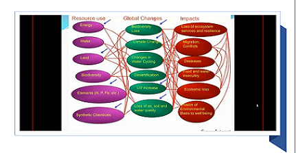
Geospatial Perspectives for global change and sustainable development (25th April 2021)
Machine Learning and Geospatial Science (05th May 2021)
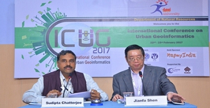
International Conference on Urban Geoinformatics, 2017
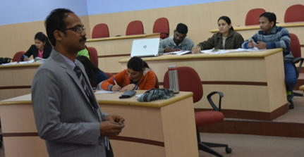
21 days training programme on Geospatial Technology; DST, 2016
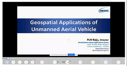
Geospatial Applications of Unmanned Aerial Vehicle
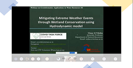
Mitigating Extreme Weather Events through Wetland Conservation using Hydrodynamic model
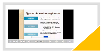
Types of Machine Learning Problems
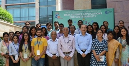
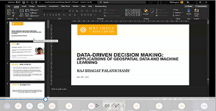
Data Science Applications for Sustainability
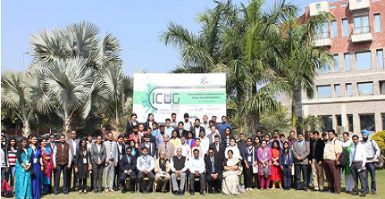
International Conference 2017
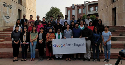
Google Earth Engine (22 Feb 2019)